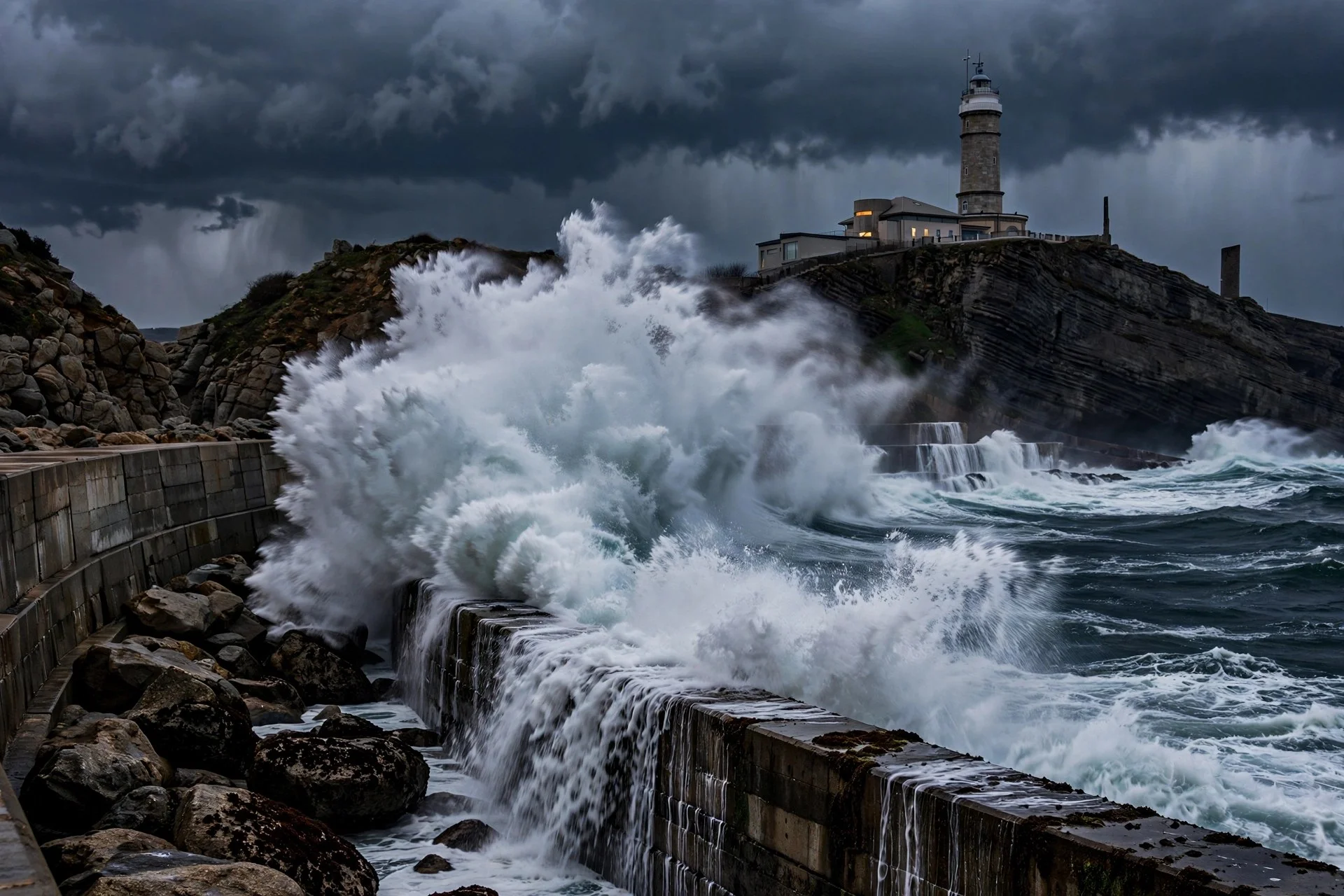
Waves of 8 meters batter Spain's northern coast under Austen
A maritime storm driven by Austen is battering the Cantabrian and Galician coasts with waves of up to 8 meters, winds of more than 100 kilometers per hour and…
Austen lashes northern Spain with 8-meter waves, strong wind
Storm Austen is bringing waves of up to 8 meters, gusts of 106 kilometers per hour and orange warnings to the Cantabrian and Galician coasts, before a general…
--- The context ---
Storm Austen, a high-impact system named by the British meteorological services, is shaking the far north of the Iberian Peninsula this Friday with a maritime storm that mainly affects the Cantabrian and Galician coasts.
According to the state meteorological agency, the effect in Spain will be smaller than in the British Isles and northern Europe, although it will still be an adverse day in Galicia, Asturias, Cantabria and the Basque Country.
--- The facts ---
Orange warnings for a significant risk from waves have been activated in those regions. Waves of more than 5 meters will be reached across wide areas of the Cantabrian and Galician coast, and in the Basque Country and Cantabria they may reach up to 8 meters in height, easing during the afternoon.
Very strong winds will blow at force 7 or 8, causing a rough sea, with more than 100 kilometers per hour. During the night and early hours, very intense gusts have already been recorded in the far north.
Up to 106 kilometers per hour were reached at places such as Matxitxako, in Bizkaia, and 103 kilometers per hour at the weather station of Estaca de Bares, in A Coruña. Gusts also exceeded 90 kilometers per hour at several points on the coast of Asturias and exceeded 80 kilometers per hour in several areas of Cantabria.
--- The positions ---
The meteorological authority warned in attributed indirect terms that the danger situation is very significant because of the rough sea.
The spokesperson of the state meteorological agency, Rubén del Campo, urged in attributed indirect terms that people be very cautious in the coastal areas affected by the storm.
--- What remains unknown ---
It is not yet known when the sea will fully improve beyond the waves easing during the afternoon, or how the outlook for the following week, with greater uncertainty, will evolve.
--- Unanswered questions ---
When will the coast return to a safe situation after the waves ease during the afternoon? Will the orange warnings remain in place for part of the day in the north? How will the greater uncertainty affect the forecast for the following week?
--- EPM analysis ---
After Austen passes, forecasts point to generally stable weather, with temperatures tending to rise toward the weekend and weak rain on Sunday in Galicia, on the Cantabrian coast and in the Pyrenees.
📌 EPM Take: In EPM's view, this Friday on the Cantabrian and Galician coast calls for real caution rather than simple curiosity about the surf, because waves of 8 meters and gusts of 106 kilometers per hour turn any coastal walk into an unnecessary risk. Storm Austen strikes Spain with less force than northern Europe, but the orange warning and the rough state of the sea are reason enough to take every official recommendation seriously and to wait until the storm eases during the afternoon before returning to the shore.
--- The context ---
A maritime storm with waves of up to 8 meters is shaking the Cantabrian and Galician coasts today because of Storm Austen, a high-impact system named by the British meteorological services.
In Spain it is striking the far north this Friday. According to the state meteorological agency, its effect will be smaller than in the British Isles and northern Europe, although the day will be adverse in the north.
--- The facts ---
Orange warnings for a significant risk from waves have been activated in those regions. Waves of more than 5 meters will occur across wide areas of the Cantabrian and Galician coast, and in the Basque Country and Cantabria they may reach up to 8 meters in height, easing during the afternoon.
Winds will be very strong, at force 7 or 8, and will cause a rough sea, with more than 100 kilometers per hour. During the night and early hours, very intense gusts have already been measured in the far north.
At Matxitxako, in Bizkaia, gusts reached 106 kilometers per hour, and at the weather station of Estaca de Bares, in A Coruña, they reached 103 kilometers per hour. Several points on the coast of Asturias exceeded 90 kilometers per hour and several areas of Cantabria recorded more than 80 kilometers per hour.
--- The positions ---
The meteorological authority pointed out in attributed indirect terms that the danger situation is very significant.
The spokesperson of the state meteorological agency, Rubén del Campo, recommended in attributed indirect terms that extreme caution be exercised in the affected coastal areas.
--- What remains unknown ---
The moment when all risk will disappear after the waves ease during the afternoon is not yet known. The forecast for the following week carries greater uncertainty, with a probable temperature drop in the north and east and in the Balearic Islands.
--- Unanswered questions ---
Until what time will the risk behind the orange warnings in the north remain in place? Will gusts above 100 kilometers per hour be recorded again this Friday? Will the probable temperature drop of the following week be confirmed?
--- EPM analysis ---
Once the storm passes, the weekend will bring stable weather and rising temperatures, with 28° in Seville on Sunday. The week from October 26 to November 1 will be stable, with temperatures above the seasonal average and scarce rainfall.
📌 EPM Take: In EPM's view, with waves of 8 meters and winds of more than 100 kilometers per hour the responsible course is clear, respect the orange warnings, stay away from exposed stretches of coast and protect life before any activity by the sea. Austen affects Spain less intensely than the British Isles, but the gusts of 106 and 103 kilometers per hour already recorded show that the danger is concrete, and the caution urged by the state meteorological agency should be followed without exception throughout this adverse day.
Olas de 8 metros golpean el litoral cantábrico por Austen
Un temporal marítimo por la borrasca Austen sacude el litoral cantábrico y gallego con olas de hasta 8 metros, vientos de más de 100 kilómetros por hora y…
Austen azota el norte con olas de 8 metros y viento fuerte
La borrasca Austen provoca un temporal en el litoral cantábrico y gallego con olas de hasta 8 metros, rachas de 106 kilómetros por hora y avisos naranjas…
--- El contexto ---
La borrasca Austen, de gran impacto y nombrada por los servicios meteorológicos británicos, sacude este viernes el extremo norte peninsular con un temporal marítimo que afecta sobre todo al litoral cantábrico y gallego.
Según la agencia meteorológica estatal, en España el efecto será menor que en las islas británicas y el norte de Europa, aunque será una jornada adversa en Galicia, Asturias, Cantabria y País Vasco.
--- Los hechos ---
Se han activado avisos de color naranja por riesgo importante de oleaje en esas comunidades. Se alcanzarán olas de más de 5 metros en amplias zonas del litoral cantábrico y gallego, y en el País Vasco y Cantabria podrán llegar hasta los 8 metros de altura, amainando por la tarde.
Soplarán vientos muy fuertes con fuerza 7 u 8, que causarán mal estado de la mar, con más de 100 kilómetros por hora. Esta noche y a primeras horas ya se han registrado rachas muy intensas en el extremo norte.
Hasta 106 kilómetros por hora se han alcanzado en puntos como Matxitxako, en Bizkaia, y 103 kilómetros por hora en la estación meteorológica de Estaca de Bares, en A Coruña. También se han superado los 90 kilómetros por hora en varios puntos del litoral de Asturias y los 80 kilómetros por hora en varias zonas de Cantabria.
--- Las posiciones ---
La autoridad meteorológica ha advertido en indirecto que la situación de peligro es muy importante por el mal estado de la mar.
El portavoz de la agencia meteorológica estatal, Rubén del Campo, ha pedido en indirecto que se sea muy prudente en las zonas litorales afectadas por el temporal.
--- Lo que falta saber ---
No se conoce cuándo mejorará por completo el estado de la mar más allá de que el oleaje amainará por la tarde, ni cómo evolucionará el pronóstico de la semana posterior, con mayor incertidumbre.
--- Preguntas sin respuesta ---
¿Cuándo recuperará el litoral una situación segura tras amainar el oleaje por la tarde? ¿Se mantendrán los avisos naranjas durante parte de la jornada en el norte? ¿Cómo afectará la mayor incertidumbre al pronóstico de la semana posterior?
--- Análisis EPM ---
Tras el golpe de Austen, las predicciones apuntan a un tiempo en general estable, con temperaturas que tenderán a subir de cara al fin de semana y lluvias débiles el domingo en Galicia, la costa cantábrica y los Pirineos.
📌 Conclusion EPM: A juicio de EPM, la jornada de este viernes en el litoral cantábrico y gallego exige prudencia real y no simple curiosidad ante el oleaje, porque olas de 8 metros y rachas de 106 kilómetros por hora convierten cualquier paseo costero en un riesgo innecesario. La borrasca Austen golpea con menos fuerza en España que en el norte de Europa, pero el aviso naranja y el mal estado de la mar bastan para tomarse en serio cada recomendación oficial y esperar a que el temporal amaine por la tarde.
--- El contexto ---
Un temporal marítimo con olas de hasta 8 metros sacude hoy el litoral cantábrico y gallego por el efecto de la borrasca Austen, de gran impacto y nombrada por los servicios meteorológicos británicos.
En España golpea este viernes el extremo norte peninsular. Según la agencia meteorológica estatal, su efecto será menor que en las islas británicas y el norte de Europa, aunque la jornada será adversa en el norte.
--- Los hechos ---
En esas comunidades se han activado avisos de color naranja por riesgo importante de oleaje. Habrá olas de más de 5 metros en amplias zonas del litoral cantábrico y gallego, y en el País Vasco y Cantabria podrán llegar hasta los 8 metros de altura, amainando por la tarde.
Los vientos serán muy fuertes, con fuerza 7 u 8, y causarán mal estado de la mar, con más de 100 kilómetros por hora. Durante la noche y a primeras horas ya se han medido rachas muy intensas en el extremo norte.
En Matxitxako, en Bizkaia, se han alcanzado 106 kilómetros por hora, y en la estación meteorológica de Estaca de Bares, en A Coruña, 103 kilómetros por hora. En varios puntos del litoral de Asturias se han superado los 90 kilómetros por hora y en varias zonas de Cantabria se han registrado más de 80 kilómetros por hora.
--- Las posiciones ---
La autoridad meteorológica ha señalado en indirecto que la situación de peligro es muy importante.
El portavoz de la agencia meteorológica estatal, Rubén del Campo, ha recomendado en indirecto extremar la prudencia en las zonas litorales afectadas.
--- Lo que falta saber ---
No consta el momento en que desaparecerá todo riesgo tras amainar el oleaje por la tarde. El pronóstico de la semana posterior presenta mayor incertidumbre, con probable descenso térmico en el norte y el este y en Baleares.
--- Preguntas sin respuesta ---
¿Hasta qué hora se mantendrá el riesgo que motiva los avisos naranjas en el norte? ¿Volverán a registrarse rachas por encima de los 100 kilómetros por hora este viernes? ¿Se confirmará el descenso térmico probable de la semana posterior?
--- Análisis EPM ---
Pasado el temporal, el fin de semana dejará tiempo estable y temperaturas en ascenso, con 28° en Sevilla el domingo. La semana del 26 de octubre al 1 de noviembre será estable, con temperaturas superiores al promedio y precipitaciones escasas.
📌 Conclusion EPM: A juicio de EPM, ante olas de 8 metros y vientos de más de 100 kilómetros por hora la conducta responsable es clara, respetar los avisos naranjas, mantenerse lejos del litoral expuesto y proteger la vida antes que cualquier actividad en la costa. Austen afecta en España con menor intensidad que en las islas británicas, pero las rachas de 106 y 103 kilómetros por hora registradas demuestran que el peligro es concreto, y la prudencia pedida por la agencia meteorológica estatal debe cumplirse sin excepciones durante toda la jornada adversa.