Dominican Republic keeps 25 areas on alert for rain this Friday
The COE and Indomet keep 25 areas on alert for trough rains this Friday the 23rd, with nine districts on yellow and 16 on green, a risk of flooding and swollen…
Yellow and green alerts cover 25 Dominican areas amid Friday rains
The COE and Indomet keep nine districts on yellow alert and 16 on green this Friday the 23rd because of trough rains, with a risk of flooding, swollen waters…
--- The context ---
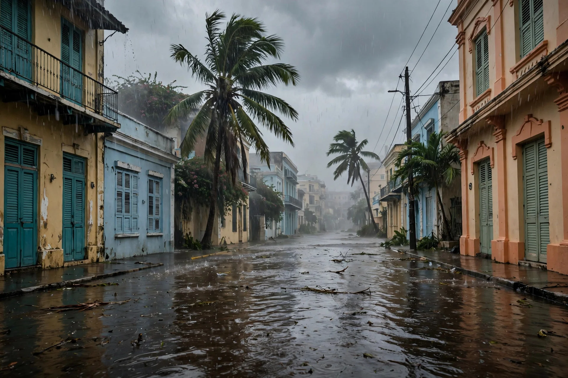
The Dominican Republic faces a rainy Friday the 23rd as a trough brings showers across much of the country. The Emergency Operations Center and the Dominican Institute of Meteorology maintain preventive measures against moderate to heavy downpours, electrical storms and gusts of wind.
--- The facts ---
According to both agencies, 25 areas remain on alert in total: nine districts on yellow alert and another 16 on green alert. The count includes 24 provinces and the National District, presented as 25 areas under preventive measures because of urban and rural flooding, swollen rivers, streams and gullies, and landslides.
The yellow alert covers Greater Santo Domingo, the National District, Puerto Plata, Pedernales, Independencia, Bahoruco, Barahona, Espaillat and Santiago. The green alert applies to San Cristóbal, Monseñor Nouel, La Vega, San Pedro de Macorís, Dajabón, San José de Ocoa and Valverde, among other provinces on the official COE map.
Meteorologist Tamaris Mercedes, of the National Forecast Center at Indomet, indicated that rainfall would concentrate during the morning along the Caribbean coastal shore, most likely in Greater Santo Domingo, Peravia, La Romana, La Altagracia, Azua, Barahona and Pedernales, and that activity would later extend during the afternoon and the early hours of the night.
--- The positions ---
The COE explained that the wider alerts respond to a trough at several levels of the troposphere and to an air mass with high moisture content, which favor cloud formation and rainfall. The agency also cited the combined effect of the trough, the warm wind from the southeast and the moisture present over the country.
Mercedes noted that moderate to heavy downpours, electrical storms and gusts could later be recorded in the southwest and southeast, the Central Mountain Range and the border zone, with exposed localities including Monte Plata, San Cristóbal, Monseñor Nouel, La Vega, San Juan de la Maguana, Elías Piña and Valverde.
The COE recommended that people not cross flooded streets, rivers, streams or gullies with high levels, nor walk through currents that reach their knees. It asked drivers to reduce speed, turn on their lights and keep a prudent distance, not leave trash that could block drains, remove items from roofs and balconies, stay away from poles and electrical cables, and follow official bulletins.
--- What remains unknown ---
It is not yet known how the trough will evolve beyond this day, whether the alerts will change in the next updates, or the concrete reach of possible swollen waters or landslides.
--- Unanswered questions ---
Will the alerts remain in place throughout Friday the 23rd? Which districts will concentrate the most intense rainfall during the afternoon and night? How will urban drains respond if the downpours persist over Greater Santo Domingo?
--- EPM analysis ---
Indomet reported that maritime conditions will be normal along both coasts, with caution for small and medium vessels southwest of Pedernales because of downpours, electrical storms and reduced visibility. Officials do not describe a generalized extreme scenario, but a day of extended caution.
📌 EPM Take: In EPM's view, a broad alert only protects people when it becomes concrete care in every neighborhood and every rural community exposed to flooding and swollen streams. Listening to the COE and Indomet, avoiding dangerous crossings and keeping drains clear are simple steps that prevent avoidable harm and protect the most exposed families. Prevention works when institutions communicate clearly, when neighbors look after one another, and when nobody underestimates a current that looks manageable during the hours of heaviest expected rain today.
--- The context ---
This Friday the 23rd, a trough keeps much of the Dominican Republic under watch. The Emergency Operations Center and the Dominican Institute of Meteorology expect moderate to heavy downpours, electrical storms and gusts of wind, with preventive measures in place.
--- The facts ---
The official balance totals 25 areas on alert: nine districts on yellow and another 16 on green, within a count that includes 24 provinces and the National District, amid urban and rural flooding, swollen rivers, streams and gullies, and landslides.
On yellow alert are Greater Santo Domingo, the National District, Puerto Plata, Pedernales, Independencia, Bahoruco, Barahona, Espaillat and Santiago. On green alert are San Cristóbal, Monseñor Nouel, La Vega, San Pedro de Macorís, Dajabón, San José de Ocoa and Valverde, among other provinces on the official COE map.
Meteorologist Tamaris Mercedes, of the National Forecast Center at Indomet, indicated that rainfall would concentrate during the morning along the Caribbean coastal shore, most likely in Greater Santo Domingo, Peravia, La Romana, La Altagracia, Azua, Barahona and Pedernales. Indomet expects activity to extend later, above all during the afternoon and the early hours of the night.
--- The positions ---
The COE explained that the wider alerts respond to a trough at several levels of the troposphere and to an air mass with high moisture content, which favor clouds and rainfall. The agency added the combined effect of the trough, the warm wind from the southeast and the moisture over the country.
Mercedes noted that during the afternoon and night moderate to heavy downpours, electrical storms and gusts could be recorded in the southwest and southeast, the Central Mountain Range and the border zone, with exposed localities including Monte Plata, San Cristóbal, Monseñor Nouel, La Vega, San Juan de la Maguana, Elías Piña and Valverde.
The COE recommended that the population not cross flooded streets, rivers, streams or gullies with high levels, nor walk through currents that reach their knees. It asked drivers to reduce speed, turn on their lights and keep a prudent distance, not leave trash, bags or objects that could block drains, remove items from roofs and balconies, stay away from poles and electrical cables, remain in a safe place and follow official bulletins.
--- What remains unknown ---
It has not yet been specified whether the alerts will remain unchanged throughout the day, what will happen with the trough in the coming days, or the points most likely to see swollen waters or landslides.
--- Unanswered questions ---
Will the yellow and green alerts change in the next COE updates? Which zones will record the strongest downpours during the afternoon and night? Will the recommended caution be enough to prevent incidents on flooded streets?
--- EPM analysis ---
At sea, Indomet reported that conditions will be normal along both coasts, with caution for small and medium vessels southwest of Pedernales because of downpours, electrical storms and reduced visibility. The message is one of order and prevention: follow official information and avoid unnecessary risks.
📌 EPM Take: In EPM's view, personal prudence is the first line of protection on a day like this: not crossing flooded streets, driving slowly and securing whatever the wind might move prevents unnecessary emergencies and evident risks at home and on the road. The alerts from the COE and Indomet are clear and arrive in time for each family to organize its day calmly and without improvisation. Heeding them responsibly protects one's own life, cares for others and eases the work of deployed civil protection teams.
República Dominicana mantiene 25 áreas bajo alerta por lluvias este viernes
El COE y el Indomet mantienen 25 áreas bajo alerta por las lluvias de una vaguada este viernes 23, con nueve demarcaciones en amarilla y 16 en verde, riesgo de…
Alerta amarilla y verde en 25 áreas dominicanas por la vaguada de este viernes
El COE y el Indomet mantienen nueve demarcaciones en alerta amarilla y 16 en verde este viernes 23 por lluvias de una vaguada, con riesgo de inundaciones…
--- El contexto ---
República Dominicana afronta este viernes 23 lluvias asociadas a una vaguada, con medidas preventivas en gran parte del país. El Centro de Operaciones de Emergencias y el Instituto Dominicano de Meteorología vigilan aguaceros de moderados a fuertes, tormentas eléctricas y ráfagas de viento.
--- Los hechos ---
Según ambos organismos, permanecen bajo alerta 25 áreas en total: nueve demarcaciones en alerta amarilla y otras 16 en alerta verde. El conteo incluye 24 provincias y el Distrito Nacional, difundido como 25 áreas bajo medidas preventivas ante inundaciones urbanas y rurales, crecidas de ríos, arroyos y cañadas, y deslizamientos de tierra.
La alerta amarilla alcanza al Gran Santo Domingo, el Distrito Nacional, Puerto Plata, Pedernales, Independencia, Bahoruco, Barahona, Espaillat y Santiago. La verde rige para San Cristóbal, Monseñor Nouel, La Vega, San Pedro de Macorís, Dajabón, San José de Ocoa y Valverde, entre otras provincias del mapa oficial del COE.
La meteoróloga Tamaris Mercedes, del Centro Nacional de Pronóstico del Indomet, indicó que las precipitaciones se concentrarán durante la mañana sobre el litoral costero caribeño, con mayor probabilidad en el Gran Santo Domingo, Peravia, La Romana, La Altagracia, Azua, Barahona y Pedernales, y que la actividad se extendería luego durante la tarde y las primeras horas de la noche.
--- Las posiciones ---
El COE explicó que la ampliación responde a una vaguada en varios niveles de la troposfera y a una masa de aire con alto contenido de humedad, que favorecen nublados y precipitaciones. El organismo sumó el efecto combinado de la vaguada, el viento cálido del sureste y la humedad presente sobre el país.
Mercedes señaló que luego podrían registrarse aguaceros moderados a fuertes, tormentas eléctricas y ráfagas en el suroeste y sureste, la Cordillera Central y la zona fronteriza, con localidades expuestas como Monte Plata, San Cristóbal, Monseñor Nouel, La Vega, San Juan de la Maguana, Elías Piña y Valverde.
El COE recomendó no cruzar calles anegadas, ríos, arroyos ni cañadas con niveles elevados, ni pasar a pie por corrientes que alcancen las rodillas. A quienes conducen les pidió reducir la velocidad, encender las luces y mantener distancia prudente, no dejar basura que bloquee desagües, retirar elementos de techos y balcones, alejarse de postes y cables eléctricos y seguir los boletines oficiales.
--- Lo que falta saber ---
No se conoce cómo evolucionará la vaguada más allá de esta jornada ni si las alertas cambiarán en próximas actualizaciones, ni el alcance concreto de posibles crecidas o deslizamientos.
--- Preguntas sin respuesta ---
¿Se mantendrán las alertas durante todo el viernes 23? ¿Qué demarcaciones concentrarán las lluvias más intensas por la tarde y la noche? ¿Cómo responderán los desagües si los aguaceros se prolongan en el Gran Santo Domingo?
--- Análisis EPM ---
El Indomet informó que las condiciones marítimas serán normales en ambas costas, con precaución para embarcaciones pequeñas y medianas al suroeste de Pedernales por aguaceros, tormentas eléctricas y menor visibilidad. No se describe un escenario extremo generalizado, sino un día de precaución extendida.
📌 Conclusion EPM: A juicio de EPM, una alerta amplia solo protege si se convierte en cuidado concreto en cada barrio y en cada comunidad rural expuesta a crecidas e inundaciones. Escuchar al COE y al Indomet, evitar cruces peligrosos y cuidar los desagües son gestos sencillos que reducen daños evitables y protegen a las familias más expuestas. La prevención funciona cuando las instituciones informan con claridad, cuando los vecinos se cuidan entre sí y cuando nadie subestima una corriente por parecer manejable durante las horas de mayor lluvia prevista.
--- El contexto ---
Este viernes 23, una vaguada mantiene en vigilancia a gran parte de República Dominicana. El Centro de Operaciones de Emergencias y el Instituto Dominicano de Meteorología prevén aguaceros de moderados a fuertes, tormentas eléctricas y ráfagas de viento.
--- Los hechos ---
El balance oficial suma 25 áreas bajo alerta: nueve demarcaciones en amarilla y otras 16 en verde, en un conteo que incluye 24 provincias y el Distrito Nacional, ante inundaciones urbanas y rurales, crecidas de ríos, arroyos y cañadas, y deslizamientos de tierra.
En alerta amarilla están el Gran Santo Domingo, el Distrito Nacional, Puerto Plata, Pedernales, Independencia, Bahoruco, Barahona, Espaillat y Santiago. En verde figuran San Cristóbal, Monseñor Nouel, La Vega, San Pedro de Macorís, Dajabón, San José de Ocoa y Valverde, entre otras provincias del mapa oficial del COE.
La meteoróloga Tamaris Mercedes, del Centro Nacional de Pronóstico del Indomet, indicó que las precipitaciones se concentrarán durante la mañana sobre el litoral costero caribeño, con mayor probabilidad en el Gran Santo Domingo, Peravia, La Romana, La Altagracia, Azua, Barahona y Pedernales. El Indomet prevé que la actividad se extienda luego, sobre todo durante la tarde y las primeras horas de la noche.
--- Las posiciones ---
El COE explicó que la ampliación responde a una vaguada en varios niveles de la troposfera y a una masa de aire con alto contenido de humedad, que favorecen nublados y precipitaciones. El organismo sumó el efecto combinado de la vaguada, el viento cálido del sureste y la humedad sobre el país.
Mercedes señaló que durante la tarde y la noche podrían registrarse aguaceros moderados a fuertes, tormentas eléctricas y ráfagas en el suroeste y sureste, la Cordillera Central y la zona fronteriza, con localidades expuestas como Monte Plata, San Cristóbal, Monseñor Nouel, La Vega, San Juan de la Maguana, Elías Piña y Valverde.
El COE recomendó no cruzar calles anegadas, ríos, arroyos ni cañadas con niveles elevados, ni pasar a pie por corrientes que alcancen las rodillas. A quienes conducen les pidió reducir la velocidad, encender las luces y mantener distancia prudente, no dejar basura, fundas ni objetos que bloqueen desagües, retirar elementos de techos y balcones, alejarse de postes y cables eléctricos, permanecer en lugar seguro y seguir los boletines oficiales.
--- Lo que falta saber ---
No se ha precisado si las alertas se mantendrán sin cambios toda la jornada ni qué ocurrirá con la vaguada en los próximos días, ni los puntos con mayor probabilidad de crecidas o deslizamientos.
--- Preguntas sin respuesta ---
¿Cambiarán las alertas amarilla y verde en las próximas actualizaciones del COE? ¿Qué zonas registrarán los aguaceros más fuertes por la tarde y la noche? ¿Bastará la precaución para evitar incidentes en calles anegadas?
--- Análisis EPM ---
En el mar, el Indomet informó que las condiciones serán normales en ambas costas, con precaución para embarcaciones pequeñas y medianas al suroeste de Pedernales por aguaceros, tormentas eléctricas y menor visibilidad. El mensaje es de orden y prevención: seguir la información oficial y evitar riesgos innecesarios.
📌 Conclusion EPM: A juicio de EPM, la prudencia personal es la primera línea de protección en una jornada como esta: no cruzar calles anegadas, conducir despacio y asegurar lo que el viento pueda mover evita emergencias innecesarias y riesgos evidentes. Las alertas del COE y del Indomet son claras y llegan a tiempo para que cada familia ordene su día con calma y sin improvisaciones. Atenderlas con responsabilidad protege la vida propia, cuida a los demás y alivia el trabajo de los equipos de protección civil desplegados.