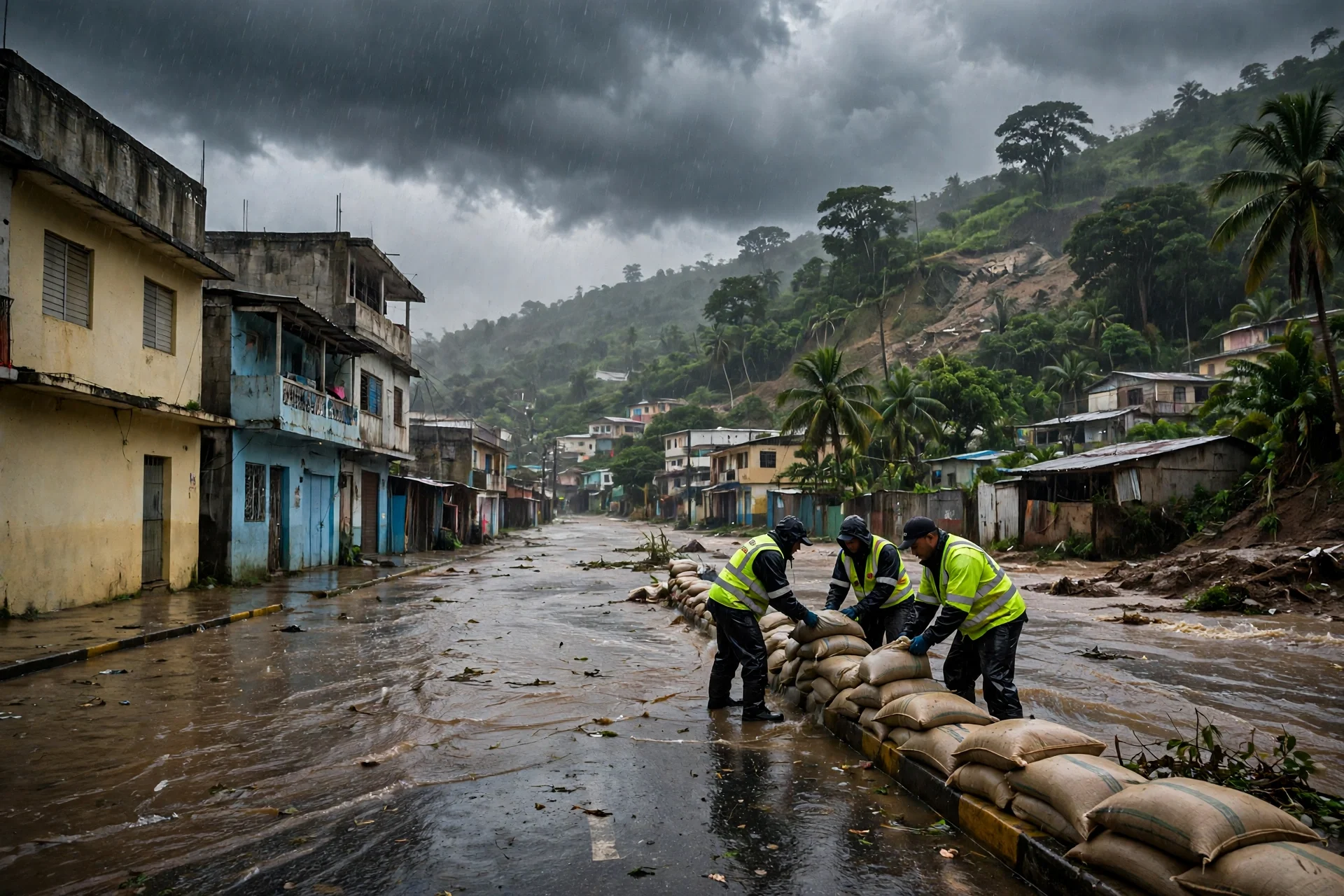
Imagen alusiva a las lluvias y las alertas vigentes por inundaciones y deslizamientos. · Erick Prometeo Media
Yellow alert held in twelve areas as rains continue
The Emergency Operations Center is keeping the National District and 11 other areas under a yellow alert due to rain, with accumulations above 200 millimeters…
Rain alerts remain as landslide risk warnings continue
The Emergency Operations Center is keeping a yellow alert in the National District and 11 other areas and a green alert in seven, as rains continue through…
--- The context ---
Rain continues to affect much of the national territory in the Dominican Republic and, according to the forecasts cited by authorities, will extend through Thursday, although with less intensity toward Friday. The Emergency Operations Center is maintaining differentiated alerts by area while urban flooding, landslides and other situations linked to the weather conditions persist across affected communities.
--- The facts ---
The Emergency Operations Center is keeping the National District and 11 other areas under a yellow alert, while seven remain under a green alert. At a press conference held on Tuesday afternoon at the center's headquarters, the executive director of the Dominican Institute of Meteorology, Gloria Ceballos, reported that rainfall accumulations had already exceeded 200 millimeters at stations in the southwest region, while Greater Santo Domingo recorded up to 113 millimeters in 24 hours, as of 2:00 in the afternoon.
Ceballos explained that the rains respond to moisture carried from the Caribbean Sea by southerly winds, combined with the influence of two troughs that are keeping the atmosphere unstable. She also specified that precipitation will continue during Wednesday and Thursday, although a reduction in intensity is expected starting Thursday, and that less significant rainfall is forecast for Friday.
--- The positions ---
The director of the Emergency Operations Center, Edwin Olivares, reported that the provinces of Pedernales, Barahona, Independencia, Azua, San José de Ocoa, San Juan, Monte Plata, Santo Domingo, San Cristóbal and Peravia remain under a yellow alert, in addition to the National District. Under a green alert are La Vega, San Pedro de Macorís, Monseñor Nouel, Santiago Rodríguez, Dajabón, Elías Piña and Hato Mayor.
Olivares said response institutions are keeping their contingency plans active and that, after a meeting with the president of the Republic, instructions were given to expand preventive measures and reinforce actions in the highest-risk zones. He also indicated that the Armed Forces, Intrant, fire departments, Civil Defense, the Red Cross and the Ministry of Public Works remain deployed in affected areas, coordinating with provincial governments and prevention, mitigation and response committees, and that Public Works placed heavy machinery at strategic points to clear roads if rains cause obstructions.
--- What remains unknown ---
It is not yet known whether additional evacuations will be necessary or what the full extent of damage will be in the localities mentioned. In Azua, rains had persisted since the morning hours and authorities were evaluating the possibility of evacuating families in Los Rosarios if precipitation continued, while surveillance continues along the banks of the Ozama River as its flow increases.
--- Unanswered questions ---
How long exactly will the current alert levels remain in place in each area? Will it be necessary to evacuate families in Los Rosarios or in other vulnerable zones if the rains continue? How will the flow of the Ozama River evolve in the coming hours? What additional measures will be adopted if the expected reduction in intensity does not occur on Thursday?
--- EPM analysis ---
The central fact of this day is not only the alert level, but the combination of already affected ground, high accumulations and rain that is still continuing. With more than 200 millimeters recorded in the southwest and 113 millimeters in 24 hours in Greater Santo Domingo, the risk described by authorities includes rising waters, landslides in vulnerable zones and road obstructions, in addition to the urban flooding already reported in different places.
📌 EPM Take: In EPM's view, the immediate priority is to protect life and keep the population informed without lowering its guard, because authorities themselves warned that this is the moment when citizens cannot afford to be careless. Avoiding flooded streets, rivers, streams and swollen ravines, watching for possible signs of landslides and following only official bulletins are concrete measures that reduce preventable harm. The coordination announced across the 31 provinces and the National District must now be demonstrated through timely preventive evacuations, cleared roads and rapid attention where water has already left communities partially cut off.
--- The context ---
The Dominican Republic is going through a period of rain that continues to affect much of the national territory and that, according to forecasts, will extend through Thursday, although with less intensity toward Friday. Against that backdrop, the Emergency Operations Center is maintaining color-coded alerts and a deployment of response institutions in the areas of greatest risk.
--- The facts ---
The Emergency Operations Center is keeping the National District and 11 other areas under a yellow alert, while seven remain under a green alert. During a press conference held on Tuesday afternoon at its headquarters, the executive director of the Dominican Institute of Meteorology, Gloria Ceballos, reported that accumulations had already exceeded 200 millimeters at stations in the southwest region and that Greater Santo Domingo recorded up to 113 millimeters in 24 hours, as of 2:00 in the afternoon.
As Ceballos explained in attributed indirect form, the rains respond to moisture carried from the Caribbean Sea by southerly winds, combined with the influence of two troughs keeping the atmosphere unstable. The precipitation has caused urban flooding and landslides, will continue during Wednesday and Thursday with an expected reduction in intensity starting Thursday, and is forecast to be less significant on Friday.
--- The positions ---
The director of the Emergency Operations Center, Edwin Olivares, detailed that Pedernales, Barahona, Independencia, Azua, San José de Ocoa, San Juan, Monte Plata, Santo Domingo, San Cristóbal and Peravia remain under a yellow alert, in addition to the National District. Under a green alert are La Vega, San Pedro de Macorís, Monseñor Nouel, Santiago Rodríguez, Dajabón, Elías Piña and Hato Mayor.
Olivares said the institutions are keeping their contingency plans active and that, after a meeting with the president of the Republic, instructions were given to expand preventive measures and reinforce actions in the highest-risk zones. The Armed Forces, Intrant, fire departments, Civil Defense, the Red Cross and the Ministry of Public Works remain deployed, coordinating with provincial governments and prevention, mitigation and response committees, with heavy machinery positioned to clear roads in case of obstructions.
--- What remains unknown ---
The complete balance of damage is still unknown, as is whether there will be new preventive evacuations. Civil Defense reported that its provincial teams and emergency committees are activated and prepared to evacuate when conditions require it, that in Azua evacuating families in Los Rosarios was being evaluated if the rains persisted, and that the banks of the Ozama River are under surveillance as its flow increases.
--- Unanswered questions ---
How quickly can roads be cleared if the rains produce new obstructions? Will cleaning drains and gutters be enough to reduce urban flooding in the next episodes? What concrete responsibility will municipal governments and each citizen assume for the waste that blocks drainage systems? Will reinforced surveillance remain in place until the landslide risk disappears completely?
--- EPM analysis ---
Alongside the emergency response, authorities raised a practical underlying problem: the cleaning of drains and ravines and citizen education. Olivares stated that preparation for the cyclone season contemplates coordination with municipal governments and Public Works to clean drains and ravines, but he also pointed out that those actions must be accompanied by greater citizen education because of the accumulation of plastics, bottles and other waste that obstructs drainage systems.
📌 EPM Take: In EPM's view, the response must combine clear authority, orderly prevention and shared responsibility, without turning the emergency into an exchange of blame while the water is still falling. Institutions have the duty to keep plans active, machinery positioned and preventive evacuations ready when warranted, and municipal governments must do their part in cleaning drains, gutters and ravines. Citizens, for their part, must avoid risky behavior and not worsen drainage with waste. Only that joint discipline, sustained before and during each intense rainfall, verifiably reduces flooding, protects roads and saves lives.
COE mantiene alerta amarilla en doce demarcaciones por lluvias
El COE mantiene en alerta amarilla al Distrito Nacional y a otras 11 demarcaciones por las lluvias, con acumulados superiores a 200 milímetros en el suroeste y…
Lluvias mantienen alerta amarilla y riesgo de deslizamientos
El COE mantiene la alerta amarilla en el Distrito Nacional y otras 11 demarcaciones y la verde en siete, ante lluvias que continuarán hasta el jueves, con…
--- El contexto ---
Las lluvias continúan afectando gran parte del territorio nacional en República Dominicana y, según los pronósticos citados por las autoridades, se extenderán hasta el jueves, aunque con menor intensidad hacia el viernes. El Centro de Operaciones de Emergencias mantiene alertas diferenciadas por demarcación mientras persisten inundaciones urbanas, deslizamientos de tierra y otras situaciones asociadas a las condiciones meteorológicas.
--- Los hechos ---
El Centro de Operaciones de Emergencias mantiene en alerta amarilla al Distrito Nacional y a otras 11 demarcaciones, mientras que siete permanecen en alerta verde. En una rueda de prensa realizada la tarde de este martes en la sede del organismo, la directora ejecutiva del Instituto Dominicano de Meteorología, Gloria Ceballos, informó que los acumulados de precipitaciones ya superaron los 200 milímetros en estaciones de la región suroeste, mientras que en el Gran Santo Domingo se registraron hasta 113 milímetros en 24 horas, hasta las 2:00 de la tarde.
Ceballos explicó que las lluvias responden al transporte de humedad desde el mar Caribe por los vientos del sur, combinado con la incidencia de dos vaguadas que mantienen la inestabilidad atmosférica. Precisó además que las precipitaciones continuarán durante el miércoles y el jueves, aunque se espera una reducción de su intensidad a partir del jueves, y que para el viernes se pronostican precipitaciones menos significativas.
--- Las posiciones ---
El director del Centro de Operaciones de Emergencias, Edwin Olivares, informó que permanecen en alerta amarilla las provincias Pedernales, Barahona, Independencia, Azua, San José de Ocoa, San Juan, Monte Plata, Santo Domingo, San Cristóbal y Peravia, además del Distrito Nacional. En alerta verde se encuentran La Vega, San Pedro de Macorís, Monseñor Nouel, Santiago Rodríguez, Dajabón, Elías Piña y Hato Mayor.
Olivares señaló que las instituciones de respuesta mantienen activos sus planes de contingencia y que, tras una reunión con el presidente de la República, se instruyó ampliar las medidas preventivas y reforzar las acciones en las zonas de mayor riesgo. También indicó que las Fuerzas Armadas, el Intrant, los cuerpos de bomberos, la Defensa Civil, la Cruz Roja y el Ministerio de Obras Públicas continúan desplegados en las áreas afectadas, con coordinaciones con las gobernaciones y los comités de prevención, mitigación y respuesta, y que Obras Públicas dispuso maquinaria pesada en puntos estratégicos para despejar vías si las lluvias provocan obstrucciones.
--- Lo que falta saber ---
Todavía no se conoce si será necesario realizar evacuaciones adicionales ni el alcance total de las afectaciones en las localidades mencionadas. En Azua las lluvias persistían desde horas de la mañana y las autoridades evaluaban la posibilidad de evacuar familias en Los Rosarios si continuaban las precipitaciones, mientras se mantiene vigilancia en las riberas del río Ozama ante el aumento de su caudal.
--- Preguntas sin respuesta ---
¿Hasta cuándo se mantendrán exactamente los niveles actuales de alerta en cada demarcación? ¿Será necesario evacuar familias en Los Rosarios o en otras zonas vulnerables si las lluvias continúan? ¿Cómo evolucionará el caudal del río Ozama en las próximas horas? ¿Qué medidas adicionales se adoptarán si la reducción prevista de la intensidad no se cumple el jueves?
--- Análisis EPM ---
El dato central de esta jornada no es solo el nivel de alerta, sino la combinación de suelos ya impactados, acumulados elevados y lluvias que todavía continúan. Con 200 milímetros superados en el suroeste y 113 milímetros en 24 horas en el Gran Santo Domingo, el riesgo descrito por las autoridades incluye crecidas, deslizamientos en zonas vulnerables y obstrucciones de vías, además de las inundaciones urbanas ya registradas en distintos puntos.
📌 Conclusion EPM: A juicio de EPM, la prioridad inmediata es proteger la vida y mantener informada a la población sin bajar la guardia, porque las propias autoridades advirtieron que este es el momento en que los ciudadanos no pueden descuidarse. Evitar cruzar calles inundadas, ríos, arroyos y cañadas crecidas, atender las señales de posibles deslizamientos y seguir únicamente los boletines oficiales son medidas concretas que reducen daños evitables. La coordinación anunciada entre las 31 provincias y el Distrito Nacional deberá demostrarse con evacuaciones preventivas oportunas, vías despejadas y atención rápida donde el agua ya dejó comunidades parcialmente incomunicadas.
--- El contexto ---
República Dominicana atraviesa un período de lluvias que continúa afectando gran parte del territorio nacional y que, según los pronósticos, se extenderá hasta el jueves, aunque con menor intensidad hacia el viernes. Ante ese escenario, el Centro de Operaciones de Emergencias mantiene alertas por colores y un despliegue de instituciones de respuesta en las zonas de mayor riesgo.
--- Los hechos ---
El Centro de Operaciones de Emergencias mantiene en alerta amarilla al Distrito Nacional y a otras 11 demarcaciones, mientras que siete permanecen en alerta verde. Durante una rueda de prensa realizada la tarde de este martes en su sede, la directora ejecutiva del Instituto Dominicano de Meteorología, Gloria Ceballos, informó que los acumulados ya superaron los 200 milímetros en estaciones de la región suroeste y que en el Gran Santo Domingo se registraron hasta 113 milímetros en 24 horas, hasta las 2:00 de la tarde.
Según explicó Ceballos en forma indirecta, las lluvias responden al transporte de humedad desde el mar Caribe por los vientos del sur, combinado con la incidencia de dos vaguadas que mantienen la inestabilidad atmosférica. Las precipitaciones han provocado inundaciones urbanas y deslizamientos de tierra, continuarán durante el miércoles y el jueves con una reducción esperada de su intensidad a partir del jueves, y para el viernes se pronostican menos significativas.
--- Las posiciones ---
El director del Centro de Operaciones de Emergencias, Edwin Olivares, detalló que permanecen en alerta amarilla Pedernales, Barahona, Independencia, Azua, San José de Ocoa, San Juan, Monte Plata, Santo Domingo, San Cristóbal y Peravia, además del Distrito Nacional. En alerta verde están La Vega, San Pedro de Macorís, Monseñor Nouel, Santiago Rodríguez, Dajabón, Elías Piña y Hato Mayor.
Olivares señaló que las instituciones mantienen activos sus planes de contingencia y que, tras una reunión con el presidente de la República, se instruyó ampliar las medidas preventivas y reforzar las acciones en las zonas de mayor riesgo. Las Fuerzas Armadas, el Intrant, los cuerpos de bomberos, la Defensa Civil, la Cruz Roja y el Ministerio de Obras Públicas continúan desplegados, con coordinación con gobernaciones y comités de prevención, mitigación y respuesta, y con maquinaria pesada posicionada para despejar vías ante posibles obstrucciones.
--- Lo que falta saber ---
Aún falta conocer el balance completo de afectaciones y si habrá nuevas evacuaciones preventivas. La Defensa Civil informó que sus equipos provinciales y los comités de emergencia están activados y preparados para evacuar cuando las condiciones lo requieran, que en Azua se evaluaba evacuar familias en Los Rosarios si persistían las lluvias y que se vigilan las riberas del río Ozama ante el aumento de su caudal.
--- Preguntas sin respuesta ---
¿Qué tan rápido podrán despejarse las vías si se producen nuevas obstrucciones por las lluvias? ¿Alcanzará la limpieza de imbornales y drenajes para reducir las inundaciones urbanas en los próximos episodios? ¿Qué responsabilidad concreta asumirán las alcaldías y cada ciudadano en la disposición de residuos que obstruyen los drenajes? ¿Se mantendrá la vigilancia reforzada hasta que el riesgo de deslizamientos desaparezca por completo?
--- Análisis EPM ---
Junto con la respuesta de emergencia, las autoridades plantearon un problema de fondo y de orden práctico: la limpieza de drenajes y cañadas y la educación ciudadana. Olivares afirmó que la preparación para la temporada ciclónica contempla la coordinación con los ayuntamientos y Obras Públicas para limpiar drenajes y cañadas, pero también señaló que esas acciones deben acompañarse de mayor educación ciudadana por la acumulación de plásticos, botellas y otros residuos que obstruyen los sistemas de drenaje.
📌 Conclusion EPM: A juicio de EPM, la respuesta debe combinar autoridad clara, prevención ordenada y responsabilidad compartida, sin convertir la emergencia en un intercambio de culpas mientras el agua sigue cayendo. Las instituciones tienen el deber de mantener planes activos, maquinaria posicionada y evacuaciones preventivas cuando corresponda, y las alcaldías deben cumplir su parte en la limpieza de imbornales, drenajes y cañadas. La ciudadanía, por su parte, debe evitar conductas de riesgo y no agravar los drenajes con residuos. Solo esa disciplina conjunta, sostenida antes y durante cada lluvia intensa, reduce inundaciones, protege vías y salva vidas de forma verificable.