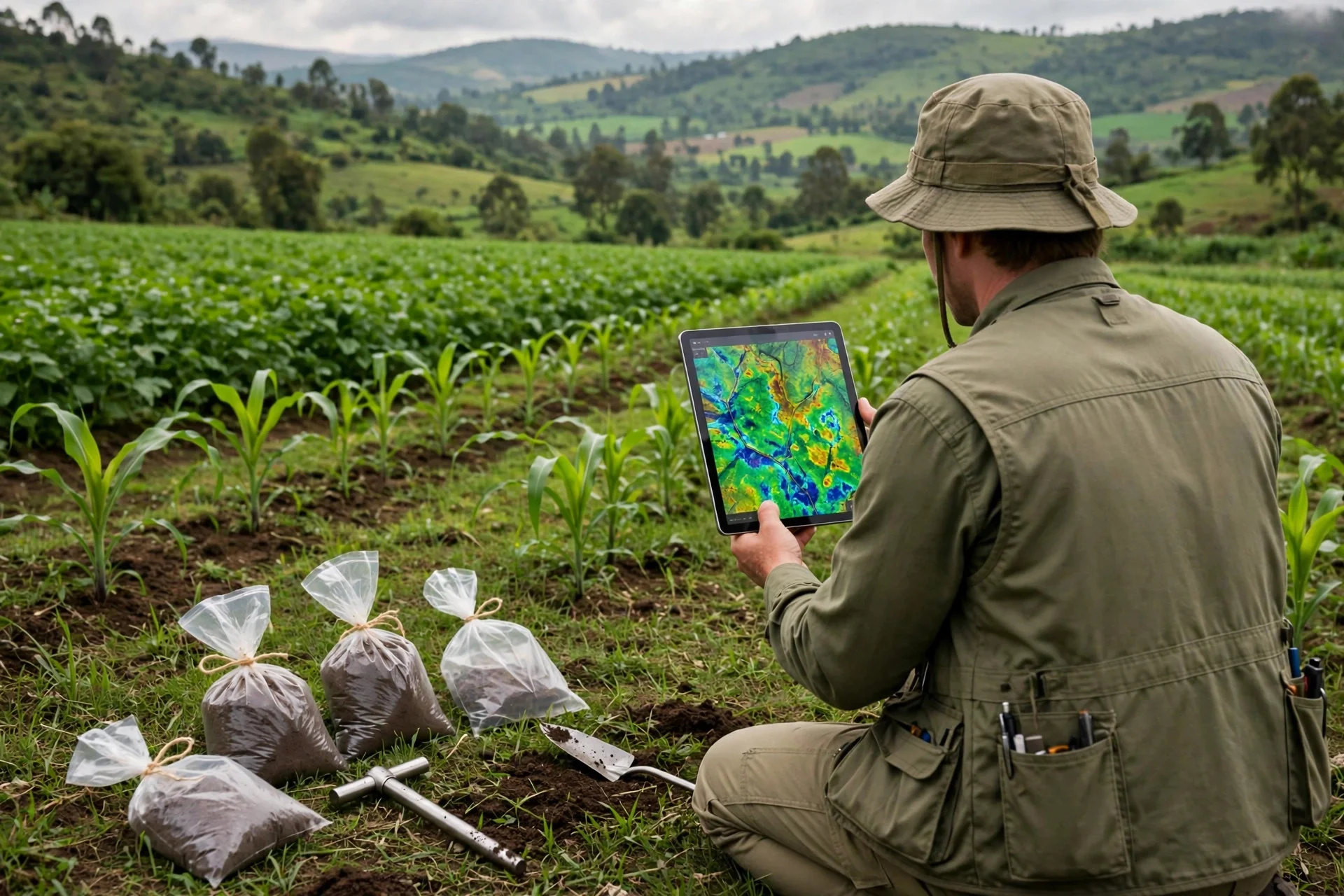
Kenya maps its soils to put knowledge in farmers' hands
The SoilFER programme has collected more than 3,600 samples across 45 counties in Kenya for a digital soil map, trains farmers as soil doctors and sends…
Kenya uses soil data to spend better on fertilizer
Kenya is building a digital soil map from more than 3,600 samples across 45 counties, with three renovated labs and results sent to mobile phones, to decide…
--- The context ---
In Kenya, deciding which fertilizer to use and how much often rests on habit, because many farmers lack reliable information about the land they work. The SoilFER programme, on soil mapping for resilient agrifood systems, seeks to close that gap by supporting farmers to develop reliable soil information that can inform agricultural decisions before planting and fertilizing.
--- The facts ---
So far, more than 3,600 soil samples have been collected and mapped across 45 counties, contributing to a digital soil map designed to provide farmers with location-specific information about their land. The samples are georeferenced, with the findings transmitted directly to farmers' mobile phones, so that useful knowledge reaches the people who cultivate the land.
The programme was launched in Kabete through a partnership between FAO and KALRO, with financial support from the United States Department of State and Japan. Through FAO support, KALRO has renovated three labs and equipped them with state-of-the-art technology to analyse samples from across the country, and the event also launched the Kenya Soil Partnership, the Kenya Soil Laboratory Network and the national rollout of the Global Soil Doctors Programme.
--- The positions ---
Select farmers receive training to diagnose and fix soil degradation, earn the title of soil doctor and then teach their peers. Agness Munialo, a farmer from Kakamega county in western Kenya and a trained soil doctor, explained indirectly that farmers once used excessive chemicals, sometimes even more fertilizer in an attempt to gain more yields, and that they now better understand soil composition, pH levels and fertility.
Barrack Okoba, the programme's national coordinator for FAO in Kenya, said indirectly that making soil information accessible is essential to building resilience in agriculture and supporting sustainable farm management. Jackline Kioko, a KALRO intern, valued indirectly how soil testing could inform decisions on her family's farm, while Cabinet Secretary for Agriculture Mutahi Kagwe called for stronger institutional collaboration, coordinated decision-making, enhanced information sharing and integrating soil health into institutional work.
--- What remains unknown ---
The source does not say how long completing the digital map will take or how many farmers in each county will receive results on their phones. It also gives no programme cost and no detail on how training for soil doctors will be sustained as the national rollout launched at the event moves forward across the country.
--- Unanswered questions ---
How many farmers will be able to consult the digital map on their phones next season? Will soil doctor training reach every county already sampled? How will the three renovated labs be funded and maintained as the programme expands?
--- EPM analysis ---
SoilFER is also being implemented in six other countries, Ghana, Guatemala, Honduras, Mozambique, Tunisia and Zambia, placing the Kenyan experience within a wider effort. Its distinctive feature is combining laboratories, a digital map and peer teaching, so knowledge does not stay locked inside an institution and can multiply across rural communities through farmers themselves.
📌 EPM Take:
In EPM's view, mapping the soil is a commitment to food security and climate resilience because it puts useful knowledge in the hands of small farmers who previously decided in the dark. Sending results to mobile phones and training soil doctors from within farming communities who then teach their peers multiplies the reach of every sample analysed in a laboratory. If the institutional collaboration Kagwe requested holds and the map keeps receiving local data, Kenya can turn simple information on composition, pH and fertility into safer harvests and rural communities better prepared against degradation.
--- The context ---
Applying fertilizer without knowing the soil means spending without measure and risking the harvest. In Kenya, the SoilFER programme, on soil mapping for resilient agrifood systems, supports farmers to develop reliable soil information that will inform concrete agricultural decisions, such as which fertilizer to use and how much to apply on each plot of land.
--- The facts ---
The work already totals more than 3,600 samples collected and mapped across 45 counties, contributing to a digital soil map designed to provide location-specific information about each farmer's land. The samples are georeferenced, with the findings transmitted directly to farmers' mobile phones, a practical channel for deciding with data at the moment of planting or fertilizing.
The programme was launched in Kabete by FAO and KALRO, with financial support from the United States Department of State and Japan. Through FAO support, KALRO renovated three labs and equipped them with state-of-the-art technology to support analysis of samples collected across the country, and the same event launched the Kenya Soil Partnership, the Kenya Soil Laboratory Network and the national rollout of the Global Soil Doctors Programme.
--- The positions ---
Select farmers are trained to diagnose and fix soil degradation, earn the title of soil doctor and then go on to teach their peers. Agness Munialo, a farmer from Kakamega county in western Kenya and a trained soil doctor, noted indirectly that farmers previously used excessive chemicals in search of higher yields and that they now understand composition, pH and fertility before applying inputs.
Barrack Okoba, the programme's national coordinator for FAO in Kenya, said indirectly that accessible information is essential for resilience and sustainable management. Cabinet Secretary for Agriculture Mutahi Kagwe called for stronger collaboration among institutions, coordinated decisions and information sharing, and urged indirectly that soil testing be considered before deciding what to plant or which fertilizer to use, while KALRO intern Jackline Kioko highlighted indirectly the value of analysing her family's farm soil.
--- What remains unknown ---
No figure has been given for the cost of maintaining the system or for the concrete fertilizer saving each farmer will achieve by applying only what the soil requires. The timetable for completing the digital map also remains open, as do the indicators that will show whether productivity improves across the sampled counties over time.
--- Unanswered questions ---
How much excess fertilizer will be avoided thanks to location-specific results? Which official indicators will measure productivity gains across the 45 counties? Will stable financing maintain the labs, the digital map and peer training over time?
--- EPM analysis ---
SoilFER is currently being implemented in six other countries, Ghana, Guatemala, Honduras, Mozambique, Tunisia and Zambia, allowing results to be compared across different settings. In Kenya, the combination of renovated laboratories, georeferenced samples and farmers teaching farmers points to a more orderly use of the public and private resources invested in agriculture.
📌 EPM Take:
In EPM's view, the value of SoilFER lies in productivity and efficiency, because every fertilization decision supported by a prior analysis avoids unnecessary spending and protects the soil that sustains the next harvest. Location-specific data, laboratories able to process it and decisions based on evidence form a sober, verifiable chain, very different from applying inputs by habit. If institutions coordinate their work as Kagwe requested and share information without duplicating efforts, the programme can show clear accountability and prove that spending better on fertilizer also means producing better.
Kenia mapea sus suelos para dar conocimiento a sus agricultores
El programa SoilFER ha recogido más de 3,600 muestras en 45 condados de Kenia para un mapa digital del suelo, forma a agricultores como doctores del suelo y…
Kenia usa datos del suelo para gastar mejor en fertilizantes
Kenia impulsa con SoilFER un mapa digital a partir de más de 3,600 muestras en 45 condados, con tres laboratorios renovados y resultados enviados al móvil…
--- El contexto ---
En Kenia, decidir qué fertilizante usar y en qué cantidad depende a menudo de la costumbre, porque muchos agricultores carecen de información fiable sobre la tierra que trabajan. El programa SoilFER, dedicado al mapeo de suelos para sistemas agroalimentarios resilientes, busca cerrar esa brecha apoyando a los productores para que dispongan de datos fiables antes de decidir.
--- Los hechos ---
Hasta ahora se han recogido y mapeado más de 3,600 muestras de suelo en 45 condados, como aporte a un mapa digital pensado para ofrecer a cada agricultor información específica sobre su propia tierra según su ubicación. Las muestras están georreferenciadas y los resultados se envían directamente a los teléfonos móviles de los agricultores.
El programa fue lanzado en Kabete mediante una alianza entre la FAO y KALRO, con apoyo financiero del Departamento de Estado de Estados Unidos y de Japón. Con apoyo de la FAO, KALRO renovó tres laboratorios y los equipó con tecnología de última generación para analizar las muestras recogidas en todo el país, y el acto de lanzamiento incluyó también la Kenya Soil Partnership, la Kenya Soil Laboratory Network y el despliegue nacional del programa mundial de doctores del suelo.
--- Las posiciones ---
Agricultores seleccionados reciben formación para diagnosticar y corregir la degradación del suelo, obtienen el título de doctores del suelo y después enseñan a sus pares. Agness Munialo, agricultora del condado de Kakamega, en el oeste de Kenia, y formada como doctora del suelo, explicó en forma indirecta que antes se aplicaban químicos en exceso, incluso más fertilizante buscando mayores rendimientos, y que ahora comprenden mejor la composición, el pH y la fertilidad del suelo.
Barrack Okoba, coordinador nacional del programa en la FAO en Kenia, sostuvo en forma indirecta que hacer accesible la información del suelo es esencial para construir resiliencia agrícola y apoyar una gestión sostenible de las fincas. Jackline Kioko, pasante de KALRO, valoró en forma indirecta poder entender cómo el análisis orienta las decisiones en la finca de su familia, mientras el secretario del Gabinete de Agricultura, Mutahi Kagwe, pidió mayor colaboración entre instituciones, decisiones coordinadas, compartir información e integrar la salud del suelo en el trabajo institucional.
--- Lo que falta saber ---
La fuente no precisa en cuánto tiempo se completará el mapa digital ni cuántos agricultores recibirán los resultados en sus móviles en cada condado. Tampoco detalla el costo ni cómo se sostendrá la formación de doctores del suelo.
--- Preguntas sin respuesta ---
¿Cuántos agricultores podrán consultar el mapa digital en su teléfono durante la próxima temporada? ¿Llegará la formación de doctores del suelo a todos los condados ya muestreados? ¿Cómo se financiará el mantenimiento de los tres laboratorios renovados cuando avance el programa?
--- Análisis EPM ---
SoilFER se implementa también en otros seis países, Ghana, Guatemala, Honduras, Mozambique, Túnez y Zambia, lo que sitúa la experiencia keniana dentro de un esfuerzo más amplio. Su rasgo distintivo es combinar laboratorio, mapa digital y enseñanza entre pares, para que el conocimiento se multiplique en las comunidades rurales.
📌 Conclusion EPM:
A juicio de EPM, mapear el suelo es una apuesta de seguridad alimentaria y de resiliencia climática porque pone conocimiento útil en manos de pequeños agricultores que antes decidían a ciegas. Que los resultados lleguen al teléfono móvil y que doctores del suelo enseñen a sus pares multiplica el alcance de cada muestra analizada. Si la colaboración institucional que pidió Kagwe se mantiene y el mapa se actualiza, Kenia puede convertir información sobre composición, pH y fertilidad en cosechas más seguras y comunidades rurales mejor preparadas frente a la degradación.
--- El contexto ---
Aplicar fertilizante sin conocer el suelo implica gastar sin medida y arriesgar el rendimiento. En Kenia, el programa SoilFER, de mapeo de suelos para sistemas agroalimentarios resilientes, apoya a los agricultores para que desarrollen información fiable del suelo que oriente decisiones concretas, como qué fertilizante usar y en qué cantidad.
--- Los hechos ---
El trabajo ya suma más de 3,600 muestras recogidas y mapeadas en 45 condados, como contribución a un mapa digital del suelo diseñado para entregar información específica por ubicación sobre la tierra de cada agricultor. Las muestras están georreferenciadas y los hallazgos se transmiten directamente a los teléfonos móviles de los agricultores, un canal práctico para decidir con datos al plantar o fertilizar.
El programa fue lanzado en Kabete por la FAO y KALRO, con apoyo financiero del Departamento de Estado de Estados Unidos y de Japón. Con apoyo de la FAO, KALRO renovó tres laboratorios con tecnología de última generación para el análisis de muestras de todo el país, y el mismo acto lanzó la Kenya Soil Partnership, la Kenya Soil Laboratory Network y el despliegue nacional del programa mundial de doctores del suelo.
--- Las posiciones ---
Agricultores seleccionados son formados para diagnosticar y corregir la degradación del suelo, reciben el título de doctores del suelo y luego enseñan a sus pares. Agness Munialo, agricultora del condado de Kakamega, en el oeste del país, y doctora del suelo formada en el programa, señaló en forma indirecta que antes se usaban químicos en exceso buscando más rendimiento y que ahora entienden la composición, el pH y la fertilidad antes de aplicar.
Barrack Okoba, coordinador nacional del programa en la FAO en Kenia, afirmó en forma indirecta que la información accesible es esencial para la resiliencia agrícola y para una gestión sostenible. Mutahi Kagwe, secretario del Gabinete de Agricultura, pidió colaboración institucional, decisiones coordinadas y compartir información, e instó en forma indirecta a pensar primero en el análisis del suelo, mientras Jackline Kioko, pasante de KALRO, destacó en forma indirecta el valor de analizar el suelo de su finca familiar.
--- Lo que falta saber ---
No se ha informado cuánto costará mantener el sistema ni qué ahorro concreto en fertilizante logrará cada agricultor al aplicar solo lo que su suelo necesita. Tampoco se detalla el calendario del mapa digital ni los indicadores para medir si la productividad mejora.
--- Preguntas sin respuesta ---
¿Cuánto fertilizante se dejará de aplicar en exceso gracias a los resultados por ubicación? ¿Qué indicadores oficiales medirán el aumento de productividad en los 45 condados? ¿Tendrá el programa financiamiento estable para mantener laboratorios, mapa digital y formación entre pares?
--- Análisis EPM ---
SoilFER se implementa además en otros seis países, Ghana, Guatemala, Honduras, Mozambique, Túnez y Zambia, lo que permite comparar resultados entre contextos distintos. En Kenia, laboratorios renovados, muestras georreferenciadas y agricultores que enseñan a agricultores apuntan a un uso más ordenado de los recursos invertidos en el campo.
📌 Conclusion EPM:
A juicio de EPM, el valor de SoilFER está en la productividad y en la eficiencia, porque cada decisión de fertilización apoyada en un análisis previo evita gasto innecesario y protege el suelo que sostiene la cosecha siguiente. Datos específicos por ubicación, laboratorios capaces de procesarlos y decisiones basadas en evidencia forman una cadena sobria y verificable, muy distinta de aplicar insumos por costumbre. Si las instituciones coordinan su trabajo como pidió Kagwe y comparten la información sin duplicar esfuerzos, el programa puede rendir cuentas claras y demostrar que gastar mejor en fertilizantes es también producir mejor.