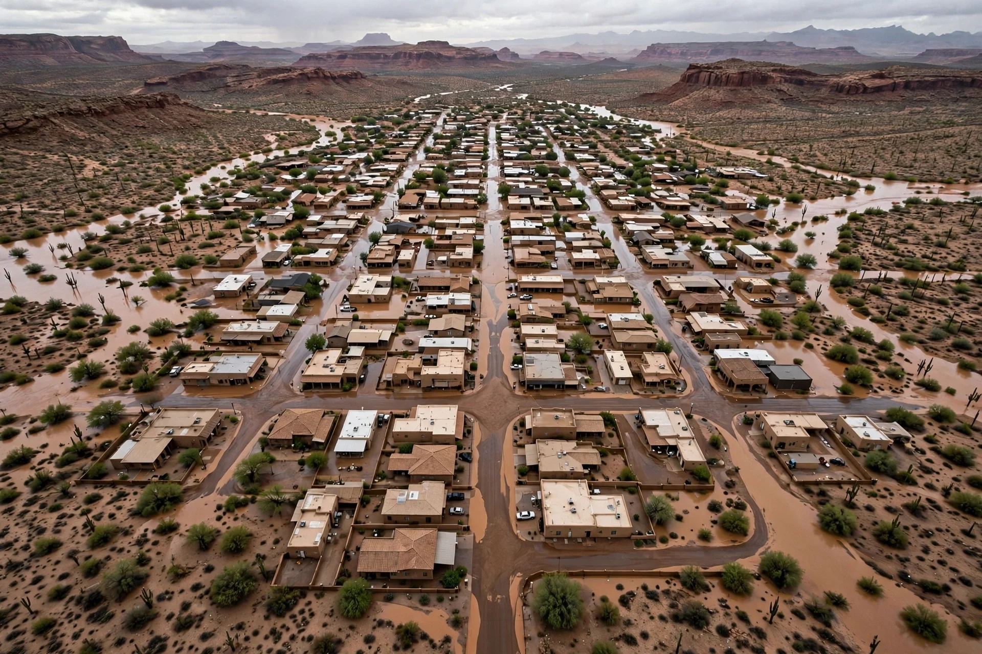
Localidad del desierto del suroeste anegada tras las lluvias, con calles cubiertas de agua marrón · Imagen generada por EPM
Rain over saturated ground threatens the Southwest again
The National Weather Service activated flood alerts across almost all of Arizona and portions of Utah, Colorado, Nevada and New Mexico, with basins saturated…
Flood alerts cover almost all of Arizona this weekend
With basins saturated and a level 3 of 4 flash flood risk, the Southwest faces rescues, preventive evacuations and a recovery in New Mexico that could exceed…
--- The context ---
The American Southwest heads into this weekend with the ground working against it. Weeks of record rainfall have left basins saturated, with no capacity to absorb the additional water expected through Monday, and over that already battered terrain the National Weather Service activated flood alerts across almost all of Arizona and portions of Utah, Colorado, Nevada and New Mexico. This is not an isolated storm over dry land, but a high-impact rain event falling on communities that have not finished recovering from the previous blow.
--- The facts ---
Forecasts indicate accumulations of up to 10 centimeters in some areas, with the highest risk focused on central and northern Arizona. The National Weather Service issued a level 3 of 4 on its flash flood risk scale for more than 168,000 square kilometers, an area home to a population of more than four million people. Damage is concentrated in the Four Corners region, where Arizona, Colorado, New Mexico and Utah meet, the epicenter of this emergency.
The chain of storms that began on October 20 overflowed the San Juan River and flooded communities within the Navajo Nation reservation and rural areas of New Mexico. Two people died and, a week later, several residents were still unable to return to their homes. On Friday, Phoenix firefighters rescued people from four vehicles trapped on flooded streets, and in Scottsdale another vehicle with two occupants entered a flooded roadway and also had to be evacuated. In Henderson, Nevada, swift-water rescue teams carried out three operations, and one of the people rescued suffered a cardiac arrest and died at the hospital. In Bullhead City, rain left water, rocks and debris across multiple roads and forced municipal parks to close.
--- The positions ---
Meteorologist Allison Santorelli, of the Weather Prediction Center in College Park, Maryland, warned in indirect terms that not much rain is needed to cause a significant impact in some of these areas, given the existing saturation. San Juan County authorities warned that, with the current hazardous-materials risks and the possibility of new rain, reentry remains dangerous. The Archuleta County Sheriff's Office asked residents of low-lying areas to evacuate preventively, noting that anyone who already has water on their property should expect more with this storm.
--- What remains unknown ---
The final extent of the damage is still unknown, as is when residents who remain displaced will be able to go home. In New Mexico alone, according to official estimates, recovery costs could exceed USD 200 million, and Governor Michelle Lujan Grisham announced that the state will seek federal funds, although so far the federal government has only approved limited assistance for emergency expenses. It is also unclear how long that help will take to reach the hardest-hit communities.
--- Unanswered questions ---
When will the residents who still cannot return to the flooded areas be able to go back to their homes? Will the federal assistance approved so far cover a recovery that in New Mexico could exceed USD 200 million? What will happen to the communities of the Navajo Nation reservation and the rural areas as the system moves into the interior of the country? Can the saturated basins receive more water without overflowing again?
--- EPM analysis ---
The pattern described by New Mexico state climatologist Dave DuBois helps explain the scale of the phenomenon: moisture is arriving farther west than usual, with tornadoes even over Santa Fe and hail the size of a golf ball, in a season he described in indirect terms as extraordinary. The El Niño phenomenon is intensifying the cycle by shifting the Pacific jet stream southward, and tropical moisture from hurricanes such as the remnants of Hurricane Trudy strengthened the rains. DuBois also stressed that, despite the damage, the rainfall benefits aquifers and ecosystems after a severe multi-year drought.
📌 EPM Take: In EPM's view, the story of this weekend is not only the rain that is coming, but the rain that already fell and left entire communities with no margin. When a saturated basin takes another hit, the damage stops being a weather statistic and becomes a question of housing, health and public money. The limited assistance approved so far contrasts with costs already measured in hundreds of millions, and that gap marks the real test for authorities: to respond in time where the water has already shown it can kill and displace.
--- The context ---
Some emergencies arrive with warning and still find communities with no room to maneuver. The American Southwest faces a high-impact rain event this weekend, with National Weather Service flood alerts across almost all of Arizona and portions of Utah, Colorado, Nevada and New Mexico. The basins, saturated by weeks of record rainfall, have no capacity to absorb the additional water expected through Monday, and that fact sits at the center of every forecast.
--- The facts ---
Accumulations of up to 10 centimeters are expected in some areas, with the highest risk over central and northern Arizona. The National Weather Service issued a level 3 of 4 flash flood risk for more than 168,000 square kilometers, with a population of more than four million people. Captain Dave Folio, of the Scottsdale fire department, warned that barely 5 centimeters of water can sweep away an automobile, and that the vehicles rescued on Friday were sitting in waters between 90 centimeters and 1.2 meters deep. That single detail captures the real danger of the day.
On Friday, Phoenix firefighters rescued people from four vehicles trapped on flooded streets. In Scottsdale, while crews were helping one driver, another vehicle with two occupants entered the same flooded area and also had to be evacuated. In Henderson, Nevada, swift-water rescue teams carried out three operations during an afternoon storm; one of the people rescued suffered a cardiac arrest and died at the hospital. In Bullhead City, water, rocks and debris forced the closure of municipal parks and complicated multiple roads.
--- The positions ---
Meteorologist Allison Santorelli, of the Weather Prediction Center in College Park, Maryland, warned in indirect terms that not much rain is needed for a significant impact given the existing saturation. San Juan County authorities held that reentry remains dangerous because of hazardous materials and the possibility of new rain. The National Weather Service in Pueblo, Colorado, urged residents to complete their preparations and warned in indirect terms that the window to prepare for flooding is closing. The Archuleta County Sheriff's Office requested preventive evacuations in low-lying areas.
--- What remains unknown ---
The chain of storms that began on October 20 overflowed the San Juan River and flooded communities in the Navajo Nation reservation and rural New Mexico; two people died and several residents were still unable to return a week later. At the Fun Valley Family Resort, near South Fork, Colorado, opened in 1959, the Rio Grande was still flowing through the camping areas a week later, with cabins crushed and trailers piled up. The river reached a flow of 200 cubic meters per second, well above the 85 recorded in an event last year that left the resort unharmed. Its manager, Kathy Smith, and her husband are working to protect what remains standing.
--- Unanswered questions ---
How much will the recovery finally cost in each affected state, and who will assume most of that bill? Will the roads and parks closed by water and debris reopen in time? Will drivers heed the warnings not to enter flooded streets after Friday's rescues? When will the residents who have not yet been able to return finally go back to their homes?
--- EPM analysis ---
After striking the Southwest, the system will advance into the interior: nearly 40 million people in a corridor from Texas to Wisconsin will come under flood threat on Monday, in a storm that could impact 35 states. For Tuesday, election day, severe storms are expected over parts of the South, and by Wednesday and Thursday the front could reach the Northeast, with rain expected in Washington D.C., New York and Boston, without rainfall for nearly two weeks. El Niño, by shifting the Pacific jet stream southward, and moisture from the remnants of Hurricane Trudy explain part of this chain.
📌 EPM Take: In EPM's view, with a saturated basin, prevention is worth more than any rescue that comes afterward. Friday's record proves it starkly: some drivers enter a flooded street while firefighters are still evacuating another driver in the very same place. Authorities have been clear in their warnings and in their calls to evacuate low-lying areas, and now immediate responsibility also falls on every family and every driver. Preparing before the window closes costs little; ignoring the alert has already cost lives in this same chain of storms.
Lluvias sobre suelo saturado amenazan de nuevo al suroeste
El Servicio Meteorológico Nacional activó alertas de inundación sobre casi todo Arizona y porciones de Utah, Colorado, Nevada y Nuevo México, con cuencas…
Alertas de inundación cubren casi todo Arizona este fin de semana
Con las cuencas saturadas y un nivel 3 de 4 de riesgo de inundaciones súbitas, el suroeste enfrenta rescates, evacuaciones preventivas y una recuperación en…
--- El contexto ---
El suroeste de Estados Unidos llega a este fin de semana con el suelo en contra. Semanas de precipitaciones récord dejaron las cuencas saturadas, sin capacidad para absorber el agua adicional que se espera hasta el lunes, y sobre ese terreno ya castigado el Servicio Meteorológico Nacional activó alertas de inundación sobre casi todo Arizona y porciones de Utah, Colorado, Nevada y Nuevo México. No se trata de una lluvia aislada sobre tierra seca, sino de un evento de alto impacto sobre comunidades que todavía no terminan de recuperarse del golpe anterior.
--- Los hechos ---
Las proyecciones indican acumulados de hasta 10 centímetros en algunas áreas, con focos de riesgo máximo sobre el centro y norte de Arizona. El Servicio Meteorológico Nacional emitió un nivel 3 de 4 en la escala de riesgo de inundaciones súbitas para más de 168.000 kilómetros cuadrados, una superficie que concentra una población superior a cuatro millones de personas. Los daños se concentran en la región de las Cuatro Esquinas, donde convergen Arizona, Colorado, Nuevo México y Utah, el epicentro de esta emergencia.
La cadena de tormentas iniciada el 20 de octubre desbordó el río San Juan e inundó comunidades dentro de la reserva de la Nación Navajo y zonas rurales de Nuevo México. Dos personas murieron y, una semana después, varios residentes seguían sin poder regresar a sus hogares. El viernes, los bomberos de Phoenix rescataron personas de cuatro vehículos atrapados en calles anegadas, y en Scottsdale otro vehículo con dos ocupantes ingresó a una arteria inundada y también debió ser evacuado. En Henderson, Nevada, los equipos de rescate en aguas rápidas realizaron tres operaciones y una de las personas rescatadas sufrió un paro cardíaco y murió en el hospital. En Bullhead City, las lluvias dejaron agua, rocas y escombros sobre múltiples vías y obligaron al cierre de parques municipales.
--- Las posiciones ---
La meteoróloga Allison Santorelli, del Centro de Predicción del Tiempo en College Park, Maryland, advirtió en términos indirectos que no se necesita mucha lluvia para causar un impacto significativo en algunas de estas zonas, dada la saturación existente. Las autoridades del condado de San Juan advirtieron que, con los actuales riesgos de materiales peligrosos y la posibilidad de nuevas lluvias, la reentrada sigue siendo peligrosa. La Oficina del Sheriff del condado de Archuleta pidió a los residentes de zonas bajas que evacuen de forma preventiva, al señalar que quien ya tiene agua en su propiedad debe esperar más con esta tormenta.
--- Lo que falta saber ---
Todavía no se conoce el alcance final de los daños ni cuándo podrán volver a casa los residentes que siguen fuera. Solo en Nuevo México, según estimaciones oficiales, los costos de recuperación podrían superar los USD 200 millones, y la gobernadora Michelle Lujan Grisham anunció que el estado gestionará fondos federales, aunque hasta ahora el gobierno federal únicamente aprobó asistencia limitada para gastos de emergencia. Tampoco está claro cuánto tardará esa ayuda en llegar a las comunidades más golpeadas.
--- Preguntas sin respuesta ---
¿Cuándo podrán regresar a sus hogares los residentes que siguen sin poder volver a las zonas inundadas? ¿Alcanzará la asistencia federal aprobada para cubrir una recuperación que en Nuevo México podría superar los USD 200 millones? ¿Qué pasará con las comunidades de la reserva de la Nación Navajo y de las zonas rurales cuando el sistema avance hacia el interior del país? ¿Están las cuencas en condiciones de recibir más agua sin nuevos desbordes?
--- Análisis EPM ---
El patrón que describe el climatólogo estatal de Nuevo México, Dave DuBois, ayuda a entender la magnitud del fenómeno: la humedad está llegando más al oeste de lo habitual, con tornados incluso sobre Santa Fe y granizo del tamaño de una pelota de golf, en una temporada que calificó en términos indirectos como extraordinaria. El fenómeno de El Niño intensifica el ciclo al desplazar hacia el sur el chorro del Pacífico, y la humedad tropical de huracanes como los remanentes del huracán Trudy potenció las lluvias. DuBois también subrayó que, pese a los daños, las precipitaciones benefician los acuíferos y los ecosistemas tras una sequía plurianual severa.
📌 Conclusion EPM: A juicio de EPM, la historia de este fin de semana no es solo la lluvia que viene, sino la que ya cayó y dejó a comunidades enteras sin margen. Cuando una cuenca saturada recibe otro golpe, el daño deja de ser un dato meteorológico y se convierte en una cuestión de vivienda, de salud y de dinero público. La asistencia limitada aprobada hasta ahora contrasta con costos que ya se miden en cientos de millones, y esa brecha marca la verdadera prueba para las autoridades: responder a tiempo donde el agua ya demostró que puede matar y desplazar.
--- El contexto ---
Hay emergencias que se anuncian con tiempo y aun así encuentran a las comunidades sin margen. El suroeste de Estados Unidos enfrenta este fin de semana un evento de lluvias de alto impacto, con alertas de inundación del Servicio Meteorológico Nacional sobre casi todo Arizona y porciones de Utah, Colorado, Nevada y Nuevo México. Las cuencas, saturadas por semanas de precipitaciones récord, no tienen capacidad para absorber el agua adicional que se espera hasta el lunes, y esa es la advertencia central de los pronósticos.
--- Los hechos ---
Se esperan acumulados de hasta 10 centímetros en algunas áreas, con riesgo máximo sobre el centro y norte de Arizona. El Servicio Meteorológico Nacional emitió un nivel 3 de 4 de riesgo de inundaciones súbitas para más de 168.000 kilómetros cuadrados, con una población superior a cuatro millones de personas. El capitán Dave Folio, de los bomberos de Scottsdale, advirtió que apenas 5 centímetros de agua pueden arrastrar un automóvil, y que los vehículos rescatados el viernes se encontraban en aguas de entre 90 centímetros y 1,2 metros de profundidad. Ese dato resume el peligro real de la jornada.
El viernes, los bomberos de Phoenix rescataron personas de cuatro vehículos atrapados en calles anegadas. En Scottsdale, mientras se asistía a un conductor, otro vehículo con dos ocupantes ingresó a la misma zona inundada y también debió ser evacuado. En Henderson, Nevada, los equipos de rescate en aguas rápidas realizaron tres operaciones durante una tormenta de la tarde; una de las personas rescatadas sufrió un paro cardíaco y murió en el hospital. En Bullhead City, el agua, las rocas y los escombros obligaron al cierre de parques municipales y complicaron múltiples vías.
--- Las posiciones ---
La meteoróloga Allison Santorelli, del Centro de Predicción del Tiempo en College Park, Maryland, advirtió en términos indirectos que no se necesita mucha lluvia para un impacto significativo dada la saturación existente. Las autoridades del condado de San Juan sostuvieron que la reentrada sigue siendo peligrosa por los materiales peligrosos y la posibilidad de nuevas lluvias. El Servicio Meteorológico Nacional en Pueblo, Colorado, instó a los residentes a completar sus preparativos y advirtió en términos indirectos que la ventana para prepararse ante las inundaciones se está cerrando. La Oficina del Sheriff del condado de Archuleta pidió evacuaciones preventivas en zonas bajas.
--- Lo que falta saber ---
La cadena de tormentas iniciada el 20 de octubre desbordó el río San Juan e inundó comunidades de la reserva de la Nación Navajo y zonas rurales de Nuevo México; dos personas murieron y varios residentes seguían sin poder regresar una semana después. En el Fun Valley Family Resort, cerca de South Fork, Colorado, inaugurado en 1959, el Río Grande seguía fluyendo por las zonas de acampe una semana después, con cabañas aplastadas y remolques amontonados. El río alcanzó un caudal de 200 metros cúbicos por segundo, muy por encima de los 85 de un evento del año pasado que dejó al resort ileso. Su gerente, Kathy Smith, y su esposo trabajan para proteger lo que permanece en pie.
--- Preguntas sin respuesta ---
¿Cuánto costará finalmente la recuperación en cada estado afectado y quién asumirá la mayor parte de esa factura? ¿Volverán a abrir a tiempo las vías y los parques cerrados por el agua y los escombros? ¿Respetarán los conductores las advertencias de no ingresar a las calles anegadas tras los rescates del viernes? ¿Cuándo podrán regresar los residentes que todavía no han podido volver a sus hogares?
--- Análisis EPM ---
Tras afectar el suroeste, el sistema avanzará hacia el interior: casi 40 millones de personas en un corredor de Texas a Wisconsin quedarán bajo amenaza de inundaciones el lunes, en una tormenta que podría impactar a 35 estados. Para el martes, día de elecciones, se prevén tormentas severas sobre partes del sur, y hacia el miércoles y el jueves el frente podría llegar al noreste, con lluvia esperada en Washington D.C., Nueva York y Boston, sin precipitaciones desde hace casi dos semanas. El Niño, al desplazar el chorro del Pacífico hacia el sur, y la humedad de los remanentes del huracán Trudy explican parte de esta cadena.
📌 Conclusion EPM: A juicio de EPM, frente a una cuenca saturada la prevención vale más que cualquier rescate posterior. Los datos del viernes lo demuestran con crudeza: hay quien ingresa a una calle anegada mientras los bomberos todavía evacuan a otro conductor en el mismo lugar. Las autoridades han sido claras en sus advertencias y en los llamados a evacuar zonas bajas, y ahora la responsabilidad inmediata pasa también por cada familia y cada conductor. Prepararse antes de que la ventana se cierre cuesta poco; ignorar la alerta ya costó vidas en esta misma cadena de tormentas.